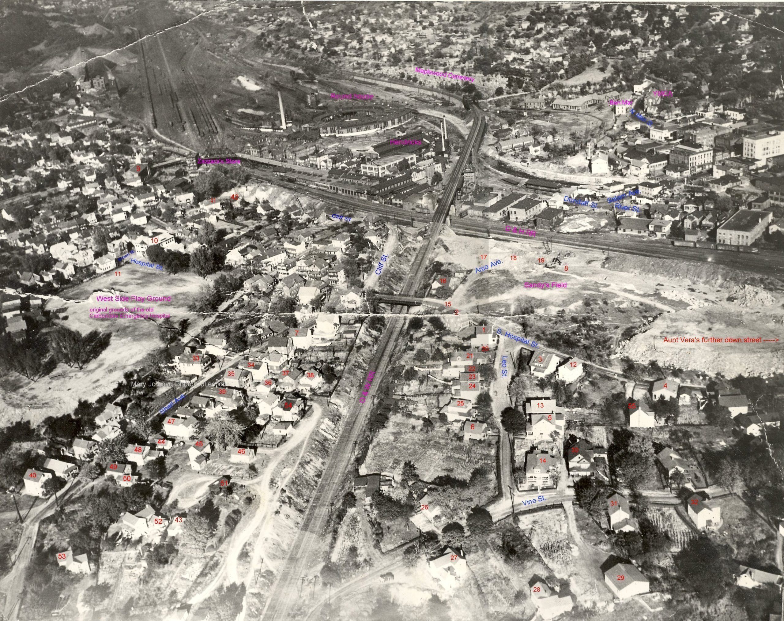
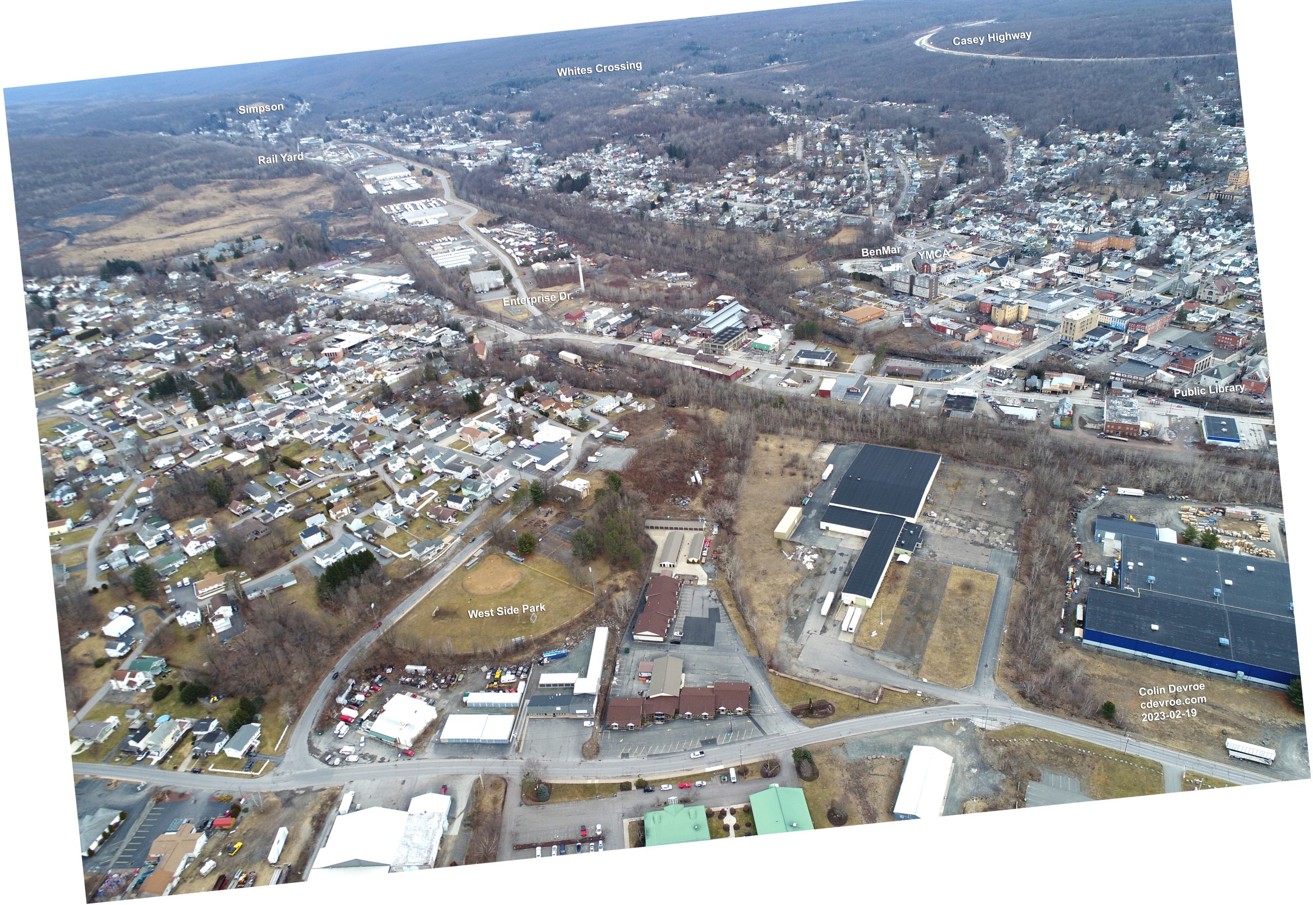
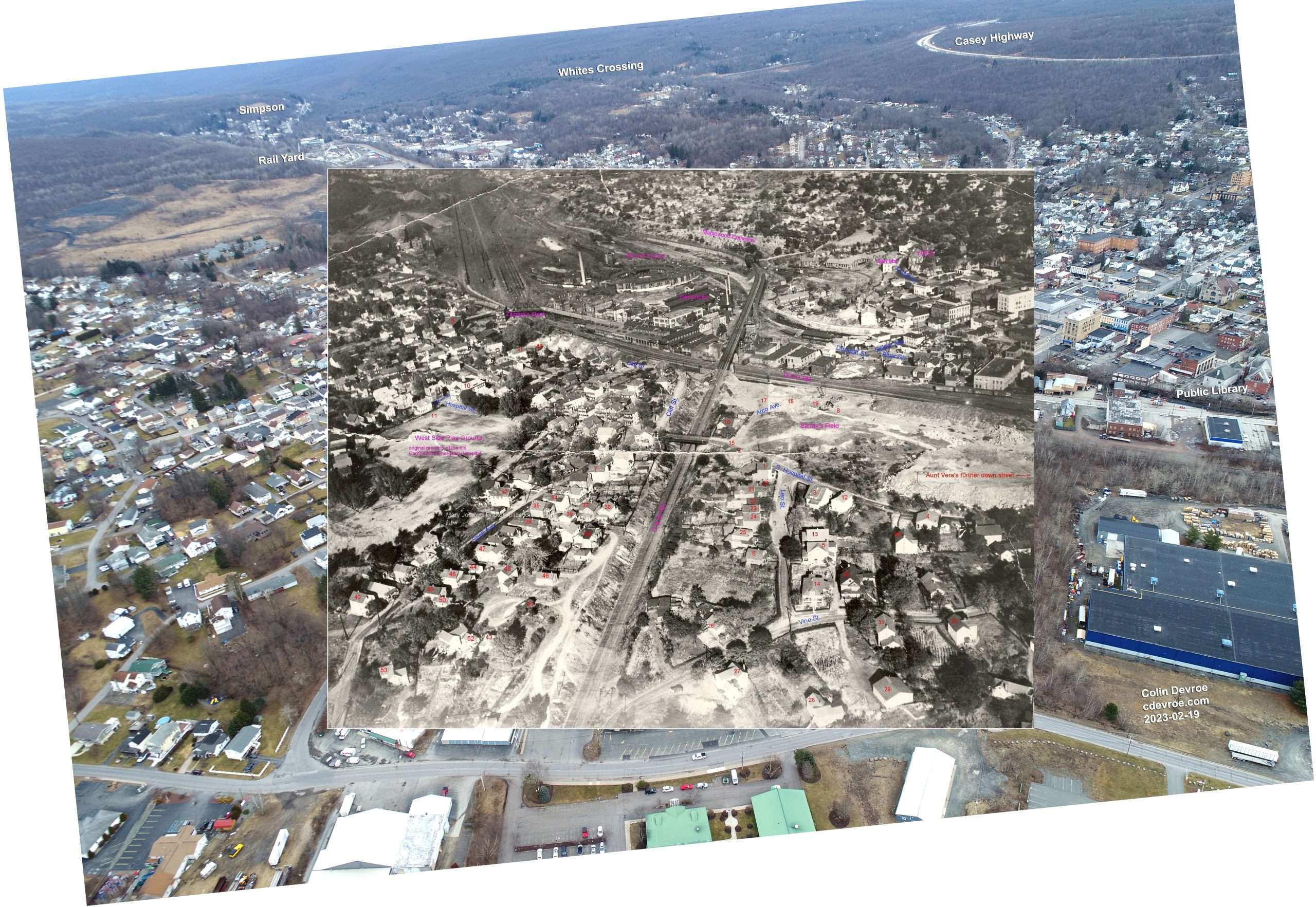
Sometime near 1948 Fiore Cerra took an aerial photograph of Carbondale, Pennsylvania that captured how very different a place it was just 75 years ago or so. I live near Carbondale and the moment I saw Cerra’s aerial I knew I wanted to try to recreate it. Well, in early 2023 I did and I uploaded a quick comparison of the two images to Instagram at the time.
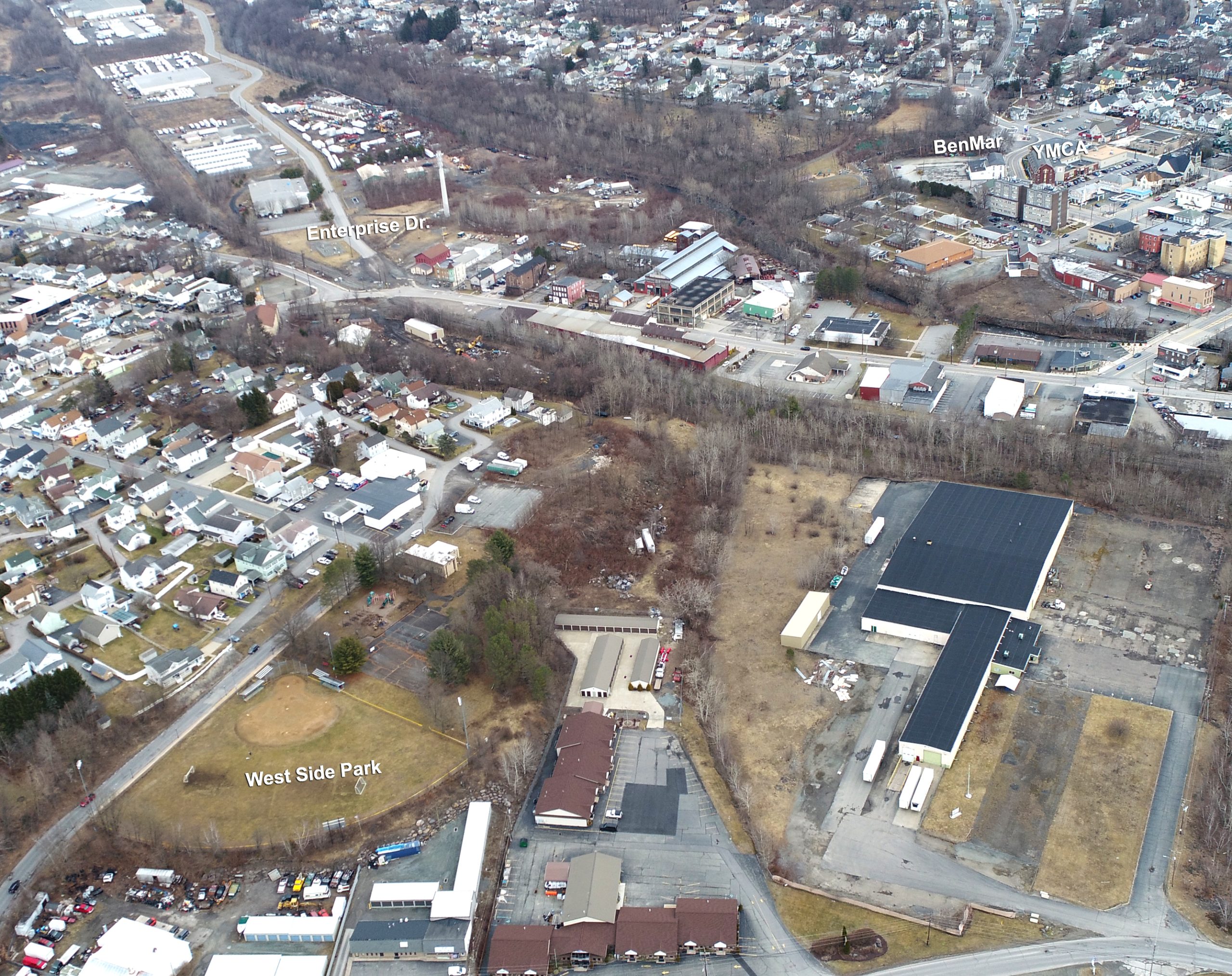
Recently, however, after talking with Cody Gonsauls – the founder of the Carbondale Township Historical Society – I knew I wanted to revisit this data and see if I could make it easier to compare the two images. This morning I uploaded a 12s video to YouTube that helps do just that. I also emailed Cody a bunch of comparison images for the society’s digital archives. Here are some of them.